 1")
What is Data and how is it useful?
Data is a collection of raw Lives facts and factual information which is processed in order to get the accurate information which is then more useful in doing or performing multiple activities.
It is useful in determining the condition of roads, where the condition of roads is worse and where it needs a repair.
In this world where everything is fast and we are all connected to the internet. Well, it’s not a bad thing but, due to this we have a ton of distractions, and we often show and perform our multitasking skills even while driving !, which is totally insane.
It is not a minute problem that can be ignored, as it is related to road safety and poses a big threat to our lives on the road.
How Data can be taken ?
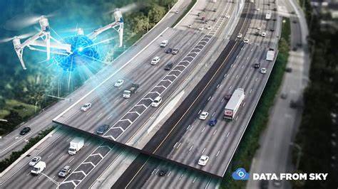
Data can be taken by various methods, but if we have to be sure then we need accurate data taken really by driving cars on the road side rather than depending upon an calculative AI. So the best way to do this is to install a dedicated hardware in cars of millennial drivers to gather information and sample raw data every few minutes. This data would include : trip id, city, state, country, location, timestamp, year of the vehicle, age, speed of the vehicle, mileage, engine RPM etc.
Now, how can it be resolved ?
There can be as many solutions for this but we have to take the most effective ones. The first thing we can do is to identify the danger zones and areas on the roads, maybe it is because of the curves or maybe because the roads are thin or for any other reason. If we can address human factors to generate personalized alerts then it will help the drivers they may be at risk.
This type of data can be also taken from satellites like the data regarding the plains and plateaus where the risk of driving is much higher.
How can Data help ?
Data taken can help in many ways, we can locate the danger zones and areas and set up to make them the alarming areas. So, when the alarms are mapped, the very next step is to make a cluster of the alarms.
The process of classification of areas described above is mainly based upon the assumptions of drivers, their speed, how they take care of their responsibility, etc.
The end goal is to create an alert system for drivers that can give them audio instructions and notifications on the real time basis, based on the level of risk of that particular area.
What can we do more with Data ?
There are more things that we can do with data. The speed data is sampled directly from the car as we have discussed above. The data like speed were taken from the personalized and dedicated hardware devices. This particular information can help to make a heat map of the average speeds on the road which can really be a boon for drivers as well as for the authorities monitoring this process.
This was the point of view of the drivers, now we should see from the eyes of authorities also what they think about this topic and about this solution.
According to the authorities, with the help of this tool, they can regulate traffic more efficiently, by just relying on the data. For example, the road authorities can adjust the speed limit by looking at the driving patterns of the people in a particular area rather than relying on some heuristic data for the setting up of the speed limit.
This also helps authorities to monitor the marked danger zone more efficiently and so if someone meets an accident the authorities who were specially monitoring that particular area can send immediate medical support to save lives on the roads.
Results :
The results after performing this type of experiment showed that the methodological way of using accessible and simple type of data in a car such as GPS system are really helpful in determining the location and with the help of dedicated devices it helped to find out the speed ratings of every second helped to identify danger zones and to set up a speed limit so as to save people from road accidents especially in the classified danger zones.
So, this type of data helped to locate and to identify danger zones. With this authorities were able to regulate traffic effectively and more accurately, the speed limit was a problem as the drivers who thought that the speed limit is not an issue drove really fast often meeting accidents in the danger zones as they didn’t knew that they were in a danger zone and the type of road or the area is not fit for speed or reckless driving. Either way reckless driving should be always avoided whether it is a smooth road or not.
Ways to ensure road safety :
These were some of the ways the described method can help save lives of people on the road, now let us discuss how drivers can themselves take precautions. Below are some of the safety tips to be followed :
- Carry all your documents regarding your car as well as regarding yourself always with you so that in any case help can be provided to you.
- If you can then, wear safety gear and always wear the seat belts properly. They are meant for safety and not for fashion.
- Well, this is kinda obvious but, do not ever drink and drive. This saves your as well as others lives on the roads.
- Avoid every distraction to ensure safety.
- Maintain and follow speed regulations.
Follow these rules and guidelines mentioned above for a safe journey on roads.
So, that was how data can help to save lives on the roads.
Now that you have reached this far, I assume that you liked the blog and you have got some value from it. To continue embracing yourself with similar knowledge, just click on the link below:
https://24x7offshoring.com/blog/
